
")

PhotoDrag (Android APP) 
An efficient system to organize and divide the photos of your works.
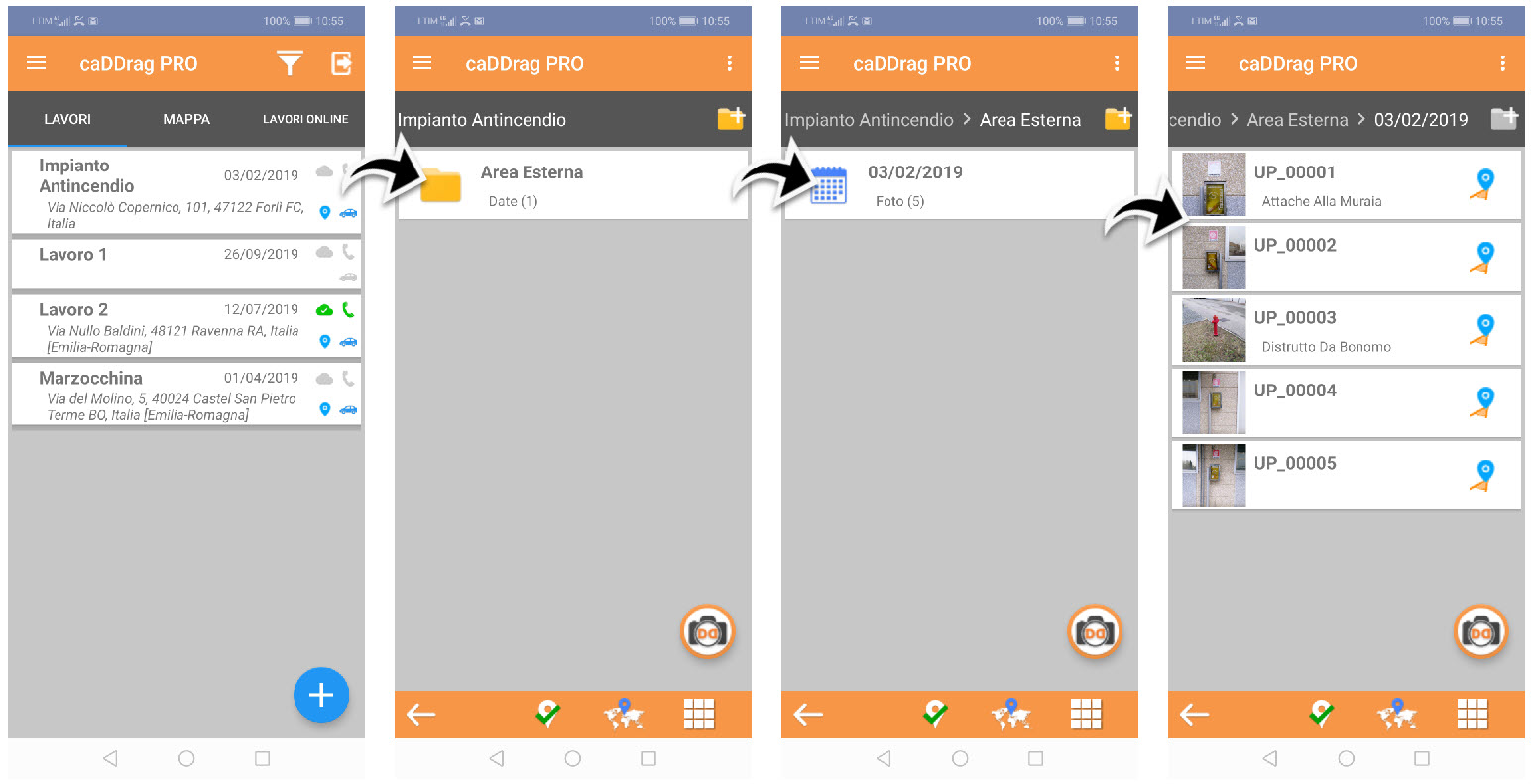
The structure is the one of the folders / subfolders you are already used to.
The first subdivision is the one of the WORKS, under which it is possible to create further levels of folders.
By taking photos, they will be saved in an additional folder with the date of the day starting from the current level.
So, going back to photographing the same area on different dates, you will find the photos split into as many folders.
In this way it will be very quick to find any shot.
Any camera installed on the smartphone can be used.
We "highly recommend" you to install and use Open Camera, a free APP that offers very interesting features.
You can download it directly, on your Smartphone, from the Play Store
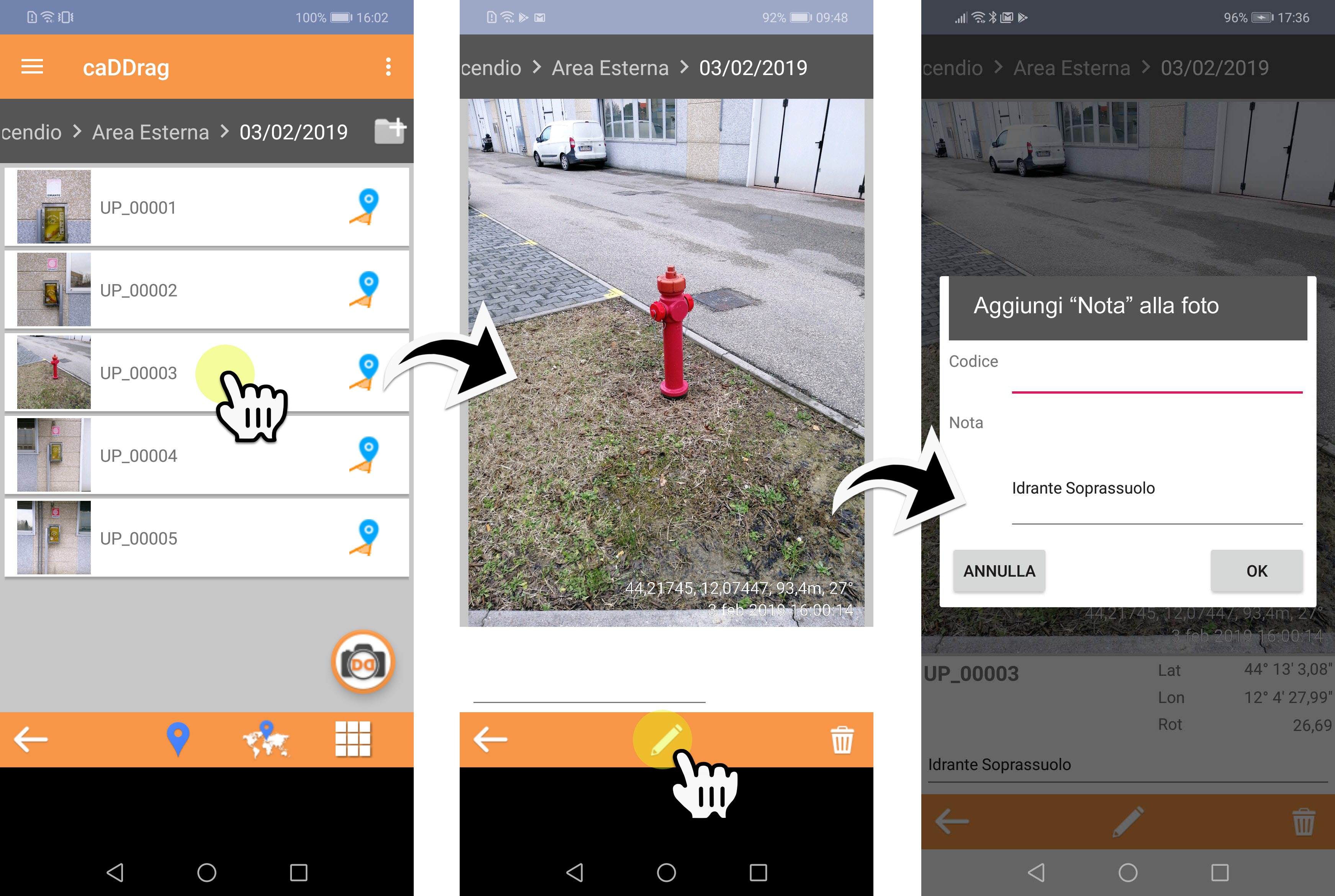
Appropriately configured, it allows you to store, in addition to the geographical coordinates of the shot, also the direction of the point of view, data not detectable by the standard camera.
It is implied that the photos have to be taken outdoors to allow geolocation through the GPS of the smartphone. Furthermore, good satellite coverage is essential to improve the accuracy of the coordinates.
This allows PhotoDrag to insert the "geo-referenced and oriented" point of view symbol, which should not be underestimated, especially if the photos frame areas which are then difficult to locate once you are back in the office.
It is possible to edit the inserted symbol to correct its position and / or rotation.
The photos can be edited to insert any note / caption and to be coded through the choice of a code from a previously loaded list, or to be integrated with a "graphic note" drawn directly on the photo.
It is possible to create different coding files compatible with the different categories of elements to be inventoried and / or mapped (street furniture, poster designing and road signage, devices for fire / alarm / ventilation / electric / hydraulic / etc. systems).
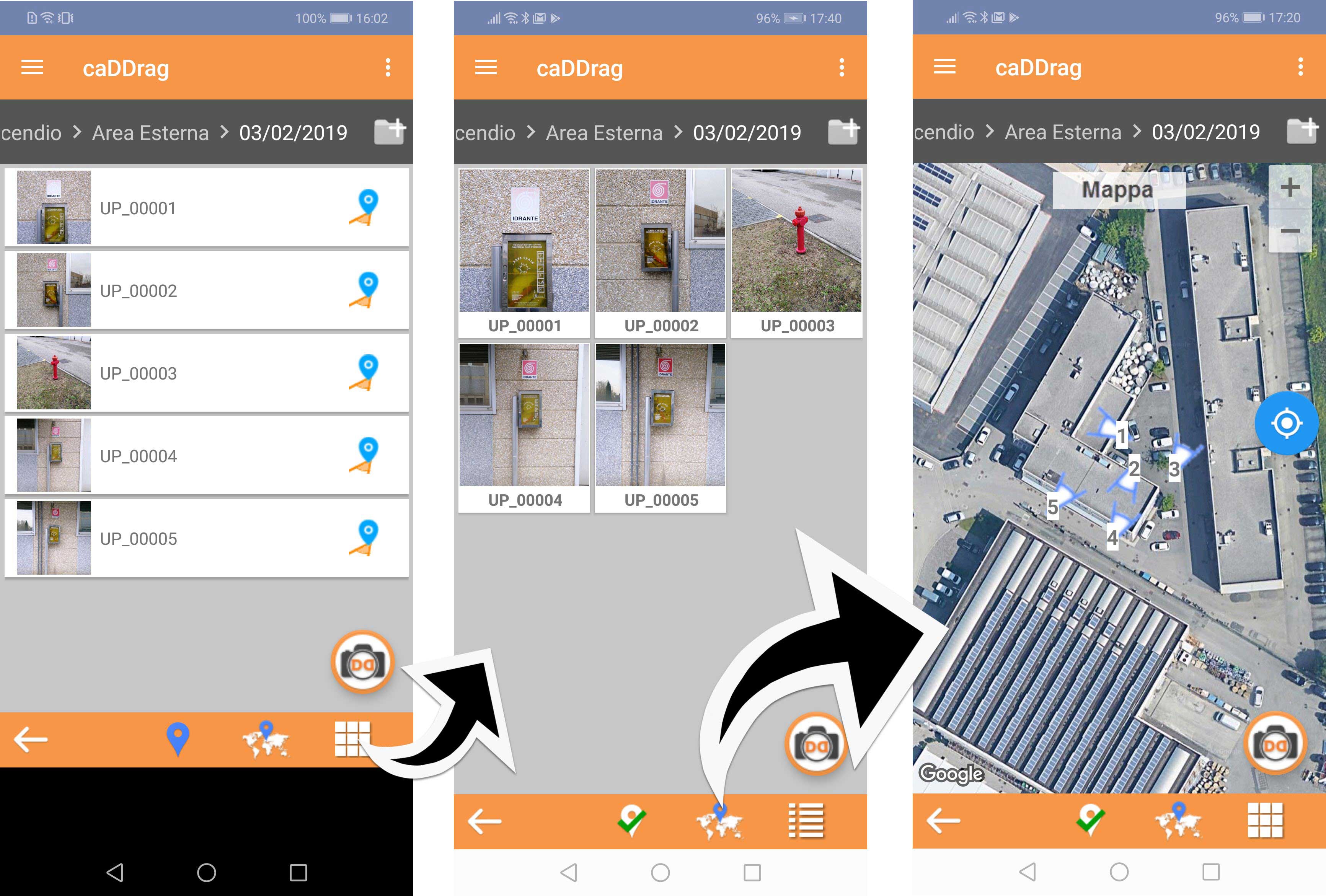
It is possible to switch from the "list view" to the "grid" and "map view" (PRO version only) which allows both the display of the photos just taken and the shooting of new photos, immediately contextualized on the map.
Moreover, it is possible to import one or more KML files (PRO version only) into a "Work" (see Loading KML files)
Once the KML file is loaded, by activating the "map view", you will find the graphic symbols superimposed on the Google Map view.
It will thus be possible to "navigate" up to the area of interest and then take photos with the certainty of being in the right place!

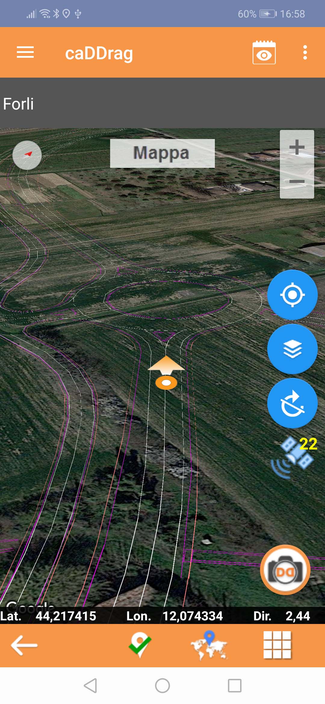
If we import multiple KML files, through the "levels" button, it is possible to activate or deactivate the view of every single level (KML).
If you wish you can, directly from the APP, "upload" the photos to your office server, or, once back in the office, file your work with just a click!
Through your Wifi network, suitably configured with your device, folders and photos will be saved directly in the path indicated on your SERVER, NAS, PC or other ...
Only new files will be copied, while those already present on the destination will be "ignored".
While copying, a progress bar will indicate the time left and when finished, a message will notify you of the outcome of the copy.

Even the APP, like the CAD application, offers different functions depending on the version purchased:
- BASE - Work management, level management, wifi storage (NO Geotag, NO map view, NO KML management, NO click contextualization on PDF / JPG image)
- PLUS - Work management, level management, wifi storage, FTP upload, PDF / JPG map import, snapshots contextualization on PDF / JPG image, photo graphic editing, PDF photo gallery export, photo data export to Excel (NO Geotag, NO map view , NO KML management)
- PRO - Work management, level management, wifi storage, PDF / JPG map import, snapshots contextualization on PDF / JPG image, photo graphic editing, map view, contextualization of geotagged shots on Google Map, KML import (augmented reality), photo gallery export in PDF, export photo data in Excel, real-time navigation, FTP upload
Enjoy yourself!